
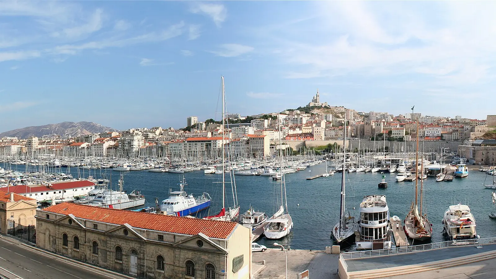

Marseille arrival and city guide
Marseille works best as three linked landscapes: port, hills and Calanques
Marseille is an ancient, restless Mediterranean port reached through Marseille Provence Airport or the elevated Saint-Charles station. Its practical city map runs through the RTM network to Vieux-Port, boats for Frioul and Château d’If, Notre-Dame de la Garde, Cours Julien, La Plaine and Parc Borély.
Transport prices, line patterns and evening service change over time. The durable plan is to use Saint-Charles as the interchange, the Old Port as the central orientation point and a separate day for coastal or Calanques travel.
- Airport
- Marseille Provence Airport (MRS)
- Rail and city hub
- Marseille Saint-Charles, above the central city
- Core urban route
- Vieux-Port, Le Panier, Mucem and Notre-Dame de la Garde
- Nature decision
- Calanques access by public transport plus walking, or by authorised boat
MRS to Saint-Charles
Treat the airport shuttle and main station as one planned interchange
The direct airport shuttle links MRS with Saint-Charles, while other rail and bus combinations may suit particular dates or terminals. Check live airport and regional-transport information rather than assuming a sub-thirty-minute journey. Traffic and the waiting interval belong in the calculation.
Saint-Charles connects to metro, buses and national rail. Walking down the monumental staircase gives a memorable arrival but is awkward with heavy luggage; the metro reaches Vieux-Port without that descent. For a Provence trip, the station may also be the point where rail outperforms a rental car.
The old harbour
Vieux-Port is a transport node, an evening walk and the city’s historical hinge
Vieux-Port deserves a central place in the itinerary. It links the Canebière, Le Panier, the Mucem side of the harbour and boats heading toward Frioul or Château d’If. A sunset here is not a separate attraction to book; it is the natural end of a day built around the port.
Boat services depend on weather, season and capacity. Choose either the Frioul islands, Château d’If or a broader coastal outing according to time, rather than assuming several can be stacked after a late start. Check the return service before leaving the quay.
Hills and neighbourhoods
Notre-Dame de la Garde and Cours Julien show opposite sides of Marseille
Notre-Dame de la Garde preserves the fishermen, votive boat models and panoramic city view remembered by the source. Its elevated position is the point: reach it by the current bus service, a demanding walk, taxi or tour according to mobility and heat. The basilica remains a place of worship, so visiting etiquette and service times matter.
Cours Julien and La Plaine provide the cafés, bookshops, street art and evening life that the old text tried to capture. They work as a separate neighbourhood exploration, not merely a place to order one coffee. Parc Borély and the beaches farther south form another cluster where gardens, coast and sunset can share a slower afternoon.
Calanques reality
The national park is not a casual extension of the city centre
Reaching a Calanque by public transport still involves walking, often on exposed terrain. Summer fire-risk controls can restrict access, and heat, footwear and water matter. Boat views offer a different experience and do not replace a hike. Verify access on the intended day before committing to a rigid plan.
- Compare the MRS flight with the airport-to-Saint-Charles journey included.
- Use the station escalators, lifts or metro when luggage makes the grand stairs impractical.
- Check live RTM service instead of reusing obsolete line counts or ticket prices.
- Keep the Calanques day flexible around official access and weather information.